

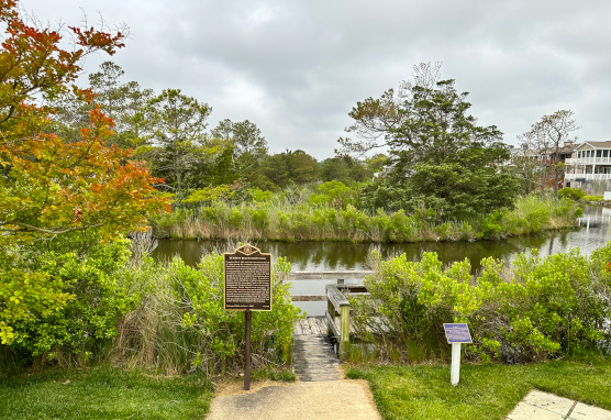
Completed July 8, 1910, the Loop Canal marked the end of a long journey for vacationers traveling to Bethany Beach in the town’s early days. Arriving in Rehoboth by railroad, travelers would continue their voyage by boat, crossing Rehoboth and Indian River Bays to the U. S. Government (Assawoman) Canal. For a time, the final portion of the trip was completed in a two-horse drawn bus through the deep sand to the town. In an effort to improve travel conditions, a shallow waterway was dredged from the Assawoman Canal to this location. Approximately 1½ miles in length, it was constructed by the Bethany Beach Improvement Company, an organization of developers and property owners. With the opening of the canal, travelers could complete the final leg of the journey by boarding a single boat in Rehoboth. Since the shallow-draft motorboat Allie May could not back up, a loop was formed here at the First Street dock to allow the boat to turn around for the return trip.
Installed in 2002. Reinstalled in 2020.
The Honorable Shirley Price, Delaware House of Representatives, 2002
The State of Delaware Historical Markers Program, 2020

123 1st Street, Bethany Beach, DE 19930
Delaware's Governor
State Directory
Elected Officials
General Assembly
Delaware Courts
State Employees
Cities & Towns
Delaware State Code
State Regulations
Business First Steps
Phone Directory
Locations Directory
Public Meetings
Voting & Elections
Transparency
Choose Health DE
Tax Center
Personal Income Tax
Privacy Policy
Weather & Travel
Contact Us
Corporations
Franchise Tax
Gross Receipts Tax
Withholding Tax
Guides to Services
Help Center
Mobile Apps
E-mail / Text Alerts
Social Media

Built by the Government Information Center
©MMXXVI Delaware.gov
