
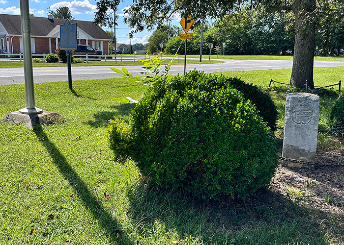
Responsible for marking boundaries of Maryland and Pennsylvania (including the “Three Lower Counties” of Delaware), Mason and Dixon began their survey of the North-South of Tangent Line at the southwestern corner of present-day Delaware in June 1764. Proceeding northward, they arrived here on July 30, forty-five miles from their starting point. They later returned to replace temporary markers with stones imported from England. Mile point stones bore the letters P and M. At five-mile points such as this, the stones included the coats of arms of the Calverts and Penns, proprietors of the colonies. In 1904, Maryland officials removed the stone for exhibition at the St. Louis World’s Fair. It was later displayed in the State House in Annapolis and then placed in storage. At the request of the citizens of Marydel, the stone was returned in 1954. It was moved a short distance from the roadside to its present location in 1968.
In 1763, Penn and Calvert Commissioners erected mile stones along the boundary between Maryland and the three lower counties (Delaware), part of the Mason-Dixon survey. Every five miles they erected elaborate crown stones. This stone was displayed in St. Louis in 1904, and later in Baltimore. It was returned to Marydel in 1954 and was reset in 1964.
Installed in 2004.
The Honorable Pamela “Pam” J. Thornburg, Delaware House of Representatives, 2004.

257 Halltown Road, Marydel, DE 19964
Delaware's Governor
State Directory
Elected Officials
General Assembly
Delaware Courts
State Employees
Cities & Towns
Delaware State Code
State Regulations
Business First Steps
Phone Directory
Locations Directory
Public Meetings
Voting & Elections
Transparency
Choose Health DE
Tax Center
Personal Income Tax
Privacy Policy
Weather & Travel
Contact Us
Corporations
Franchise Tax
Gross Receipts Tax
Withholding Tax
Guides to Services
Help Center
Mobile Apps
E-mail / Text Alerts
Social Media

Built by the Government Information Center
©MMXXVI Delaware.gov
