Maps are an excellent source for beginning your research, because they provide much useful information at a glance. Many historic maps show individual buildings and are especially useful because they also record owners’ names and features in the surrounding community. More detailed maps reveal property acreage and estate names. By examining a series of maps, you will be able to date changes in your property over time.
These are the most useful maps for researching historic properties in New Castle County, Delaware:
Samuel Rea & Jacob Price, Map of New Castle County, 1849. D. G. Beers, Atlas of the State of Delaware, 1868. G. M. Hopkins, Map of New Castle County, 1881, G. Will. Baist, Atlas of New CastIe County, 1893.
All available at DSA, HSD, HML, and some County Libraries.
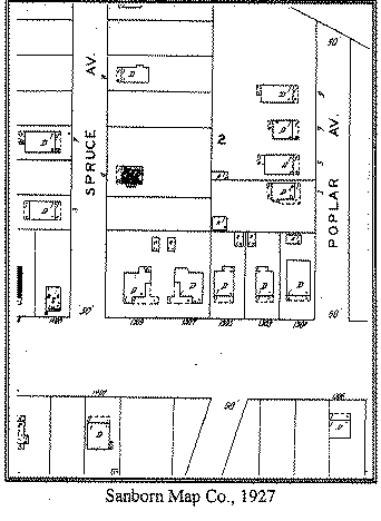
If your building is located within a city, small town, or early suburb, seek out the Sanborn Insurance Company maps for your community. The insurance maps are very detailed, showing building dimensions, additions, and descriptions of construction materials. The first Sanborn maps in this area date to 1884.
Originals available at HSD, copies at D8A, UD on microfilm no. 3333, and HML at call no. F G 1265 82 1885

Delaware's Governor
State Directory
Elected Officials
General Assembly
Delaware Courts
State Employees
Cities & Towns
Delaware State Code
State Regulations
Business First Steps
Phone Directory
Locations Directory
Delaware Public Meetings
Voting & Elections
Transparency
Choose Health DE
Tax Center
Personal Income Tax
Privacy Policy
Weather & Travel
Contact State Agencies
Corporations
Franchise Tax
Gross Receipts Tax
Withholding Tax
Guides to Services
Help Center
Mobile Apps
E-mail / Text Alerts
Social Media

Built by the Government Information Center
©MMXXVI Delaware.gov