

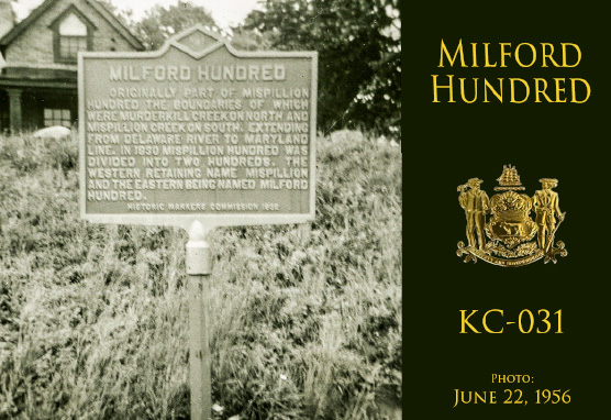
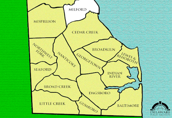
Originally part of Mispillion Hundred, the boundaries of which were Murderkill Creek on north and Mispillion Creek on south, extending from Delaware River to Maryland line. In 1830 Mispillion Hundred was divided into two hundreds, the western retaining the name Mispillion and the eastern being named Milford Hundred.
Installed in 1932.
Historic Markers Commission, 1932.
Under Review.
1055 North Walnut Street, Milford, DE 19963
Delaware's Governor
State Directory
Elected Officials
General Assembly
Delaware Courts
State Employees
Cities & Towns
Delaware State Code
State Regulations
Business First Steps
Phone Directory
Locations Directory
Public Meetings
Voting & Elections
Transparency
Choose Health DE
Tax Center
Personal Income Tax
Privacy Policy
Weather & Travel
Contact Us
Corporations
Franchise Tax
Gross Receipts Tax
Withholding Tax
Guides to Services
Help Center
Mobile Apps
E-mail / Text Alerts
Social Media

Built by the Government Information Center
©MMXXVI Delaware.gov
