 SC-182: originally installed in 2004.
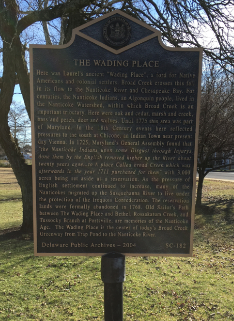
Here was Laurel’s ancient “Wading Place”, a ford for Native Americans and colonial settlers. Broad Creek crosses this fall in its flow to the Nanticoke River and the Chesapeake Bay. For centuries, the Nanticoke Indians, an Algonquin people, lived in the Nanticoke Watershed, within which Broad Creek is an important tributary. Here were oak and cedar, marsh and creek, bass and perch, deer and wolves. Until 1775 this area was part of Maryland. In the 18th Century events here reflected pressures to the south at Chicone, an Indian Town near present-day Vienna. In 1725, Maryland’s General Assembly found that “the Nanticoke Indians upon some Disgust through Injurys done them by the English removed higher up the River about twenty years agoe…to A place Called broad Creek which was afterwards in the year 1711 purchased for them” with 3,000 acres being set aside as a reservation. As the pressure of English settlement continued to increase, many of the Nanticokes migrated up the Susquehanna River to live under the protection of the Iroquois Confederation. The reservation lands were formally abandoned in 1768. Old Sailor’s Path between The Wading Place and Bethel, Rossakatum Creek, and Tussocky Branch at Portsville, are memories of the Nanticoke Age. The Wading Place is the center of today’s Broad Creek Greenway from Trap Pond to the Nanticoke River.
Location: near the intersection of Delaware Ave. and Front Street on SE side of the bridge over Broad Creek Laurel, DE 19956
Delaware's Governor
State Directory
Elected Officials
General Assembly
Delaware Courts
State Employees
Cities & Towns
Delaware State Code
State Regulations
Business First Steps
Phone Directory
Locations Directory
Delaware Public Meetings
Voting & Elections
Transparency
Choose Health DE
Tax Center
Personal Income Tax
Privacy Policy
Weather & Travel
Contact State Agencies
Corporations
Franchise Tax
Gross Receipts Tax
Withholding Tax
Guides to Services
Help Center
Mobile Apps
E-mail / Text Alerts
Social Media

Built by the Government Information Center
©MMXXVI Delaware.gov